About RTS
Welcome to the Reactive Towed Sonar Research Institute (RTS)!
Founded in 1976 by George E. Nesmith, RTS emerged as a pioneer in the commercial application of groundbreaking sonar technologies. By harnessing the power of phased and towed array sonar systems, RTS revolutionized the process of locating sunken ships and mapping the ocean floor with remarkable speed and precision.
In its early days, RTS achieved astounding success by conducting close to a dozen accurate mappings of previously lost vessels in the Bermuda-Puerto Rico region between the 19th and 33rd parallels. The introduction of their state-of-the-art phased array sonar marked a new era in bathymetric mapping.
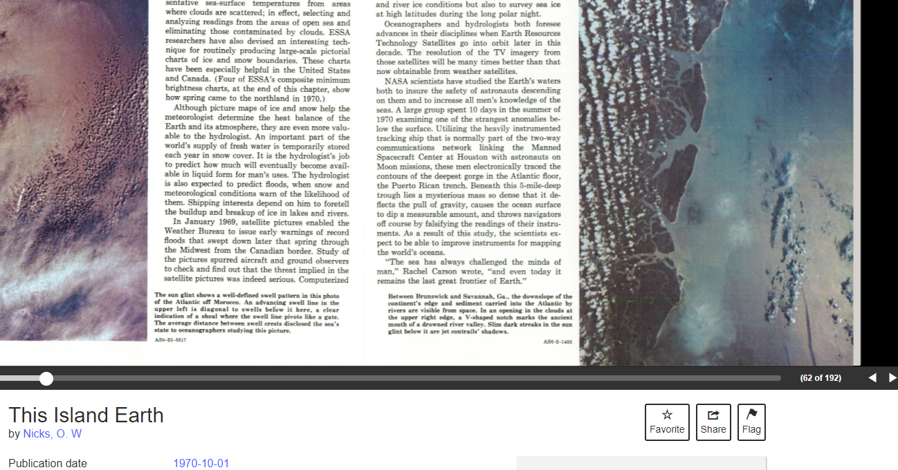
The institute's reputation for excellence gained further momentum in 1985 when RTS secured a significant contract for the Caribbean-Bermuda U.S. (CBUS) Submarine Cable Network. This ambitious project aimed to connect Bermuda with the British Virgin Islands, but the challenging Puerto Rico Trench posed a critical obstacle. With its expertise in precise mapping techniques, RTS was the natural choice to overcome this hurdle. Accurate and detailed mapping of the trench's depths, estimated to exceed 27,000 feet (Puerto Rico Trench, (1970) Nicks, Oran W. 'This Island Earth' ft. LCCN 73608969), became paramount for successful slacklining, deployment, and anchorage of the submarine cable network.
As we grow and engage in new contracts and research, our team at RTS acquired a substantial facility in the picturesque Ferry Reach area of St. George's Island, Bermuda, and swiftly expanded our team to include marine biologists, geologists, mapping specialists, and material reclamation experts. While the ability to survey via sonar is critical, we have come to appreciate the importance of studying important findings up close, including dive teams for certain objects of importance.
Throughout its illustrious history, RTS has remained at the forefront of sonar research and underwater mapping. Our unwavering commitment to cutting-edge technology and precision mapping continues to make RTS a trusted partner in various commercial ventures and critical infrastructure projects.
Join us as we reach into the depths, explore new frontiers, and redefine the boundaries of maritime knowledge.